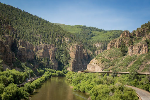
I-70 Glenwood Canyon
About the I-70 Mountain Corridor Through Glenwood Canyon
Today, traveling on the I-70 Mountain Corridor through Glenwood Canyon is more than just a trip from one place to another—it's an experience. This breathtaking stretch of highway offers one of the most scenic drives in the United States, but it's far more than just a beautiful route. Glenwood Canyon is a vital economic artery for Colorado and the greater Mountain West, connecting major cities and serving as a key route for commerce, tourism, and transportation.
Whether you're just passing through on your way to destinations like Glenwood Springs, Aspen, or Vail, or you're planning to spend time exploring the canyon, Glenwood Canyon has something for everyone—families, outdoor enthusiasts, and nature lovers alike. It’s not only a natural wonder but an essential link that supports the region's economy and connects communities across the state.
Visit the Frequently Asked Questions area for more information.

Prepare for Traveling on I-70 in Glenwood Canyon
- Plan ahead, know before you go and check for the latest road conditions by going to COtrip.org
- Know the latest weather conditions
- Give yourself extra time and avoid traveling during adverse weather conditions
- Have an emergency kit in your vehicle, including extra food, water, medicine, clothing, batteries and other necessities – enough to sustain you for 10 hours
- Make sure your car is in safe driving condition with adequate tires
- When on the road, obey the speed limit and don’t follow too closely; speeding and tailgating are among the leading causes of crashes, injuries and fatalities
What You Can Do Along the Way
If you’re traveling through Glenwood Canyon, there’s a lot more to see and do than just drive. The area is packed with opportunities for outdoor adventure and relaxation. Here are a few highlights for those stopping along the way:
Rest Areas & Scenic Stops
There are several rest areas along I-70, including No Name, Grizzly Creek, Hanging Lake and Bair Ranch where you can stop, stretch your legs, and learn about the area. Hanging Lake, in particular, is famous for its clear blue waters and stunning waterfall—just make sure to plan ahead, as the hike requires a reservation.
- Tip: Rest area information and status can be found on COtrip by selecting the Rest Areas and Welcome Centers layer, as well as Scenic Byways on I-70!
Hiking & Biking
- The canyon has a dedicated recreation path for walking, biking, and jogging that runs alongside the highway. Whether you want a short stroll or a more challenging bike ride, this path gives you a great way to explore the canyon up close.
Rafting
- The Colorado River, which runs through the canyon, is popular for whitewater rafting. If you're looking for an adrenaline rush, there are local companies that offer guided rafting trips through the canyon's fast-moving waters.
Wildlife Watching
The canyon is home to a variety of wildlife, including deer, elk, eagles, and other birds. While driving through, it’s not uncommon to catch glimpses of these animals, especially in the quieter morning or evening hours.
Frequently Asked Questions (FAQ)
Travelers planning to drive through I-70 in Glenwood Canyon, visit rest areas, or use the recreation path in Glenwood Canyon should monitor road conditions on COtrip.org, the COtrip Planner App, nearby I-70 digital message boards, and weather forecasts. Regardless of the season, CDOT recommends that travelers always be prepared with an emergency kit containing water, snacks, a flashlight, and a blanket, as mountain conditions can change suddenly.
If a safety closure of I-70 is expected to last longer than one hour, CDOT recommends motorists take an alternate route to reach their destination. Please see below for the recommended alternate route. CDOT will reopen I-70 in Glenwood Canyon once it is safe for the traveling public.
The alternate route will add approximately two and a half hours of travel time compared to taking I-70 through Glenwood Canyon. By following the recommended route, motorists can avoid major delays caused by rough roads and other hazards.
- Westbound I-70: Motorists coming from the Denver metro area or Interstate 25 can travel westbound on I-70 to Silverthorne, then head north on CO 9. In Kremmling, travelers should turn onto westbound US Highway 40 toward Steamboat Springs. After reaching Craig, motorists can head south on CO 13 toward Rifle, where they can rejoin I-70 westbound.
- Eastbound I-70: Motorists traveling eastbound from Utah or Grand Junction can follow the same route in reverse to reach the Denver metro area. In addition, for destinations south of the I-70 Mountain Corridor, motorists can travel on US 50 from Grand Junction.
Real-time road updates and conditions are available 24/7 at COtrip.org or on the COtrip Planner App.
Please note that high runoff may cause sections of the path to close on short notice and for an undetermined length of time. For the most current information about Glenwood Canyon or the Glenwood Canyon Recreation Path, contact CDOT Region 3 offices Monday through Friday from 8 a.m. to 4 p.m. at 1-970-243-2368, ext. 9.
