Highway of Legends
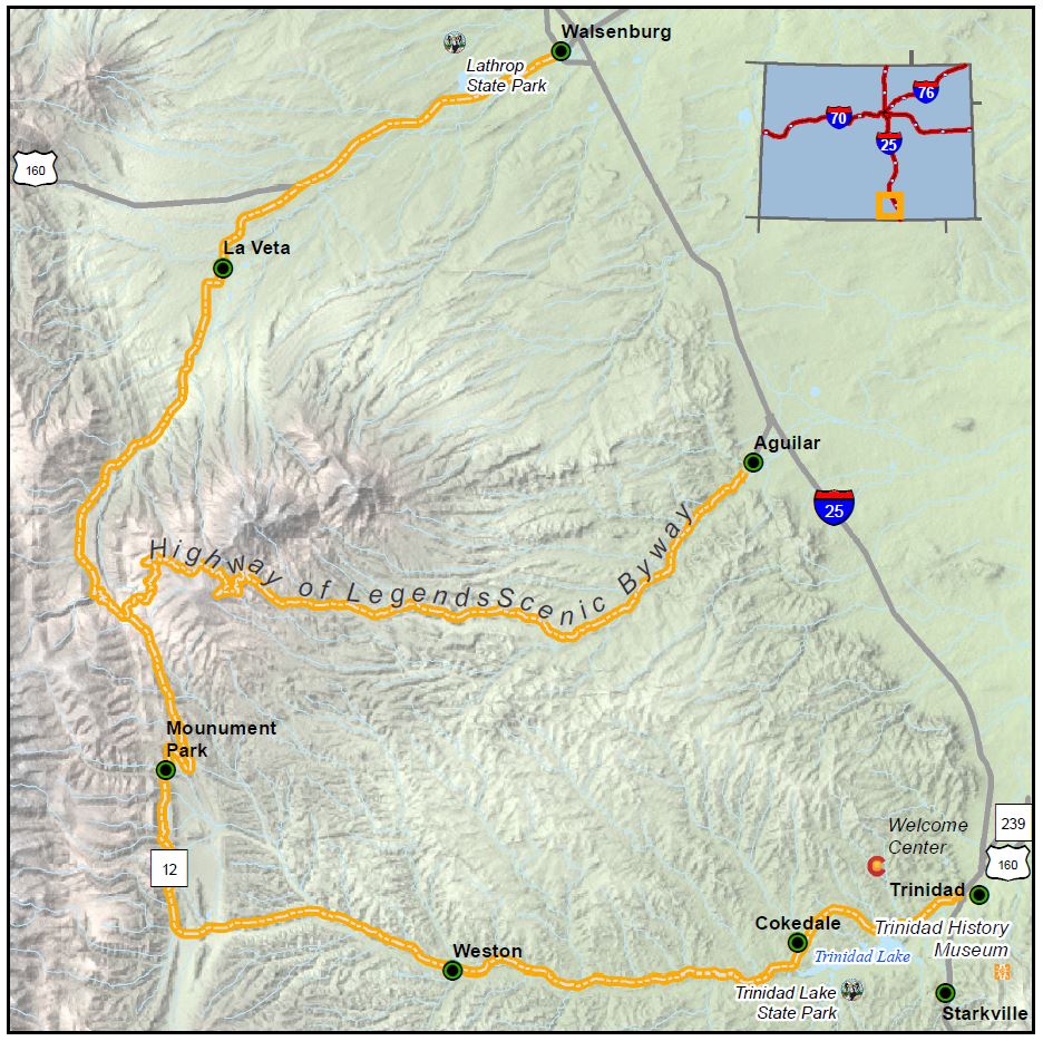
Length: 82 miles
Driving time: 2 hours
Did George Simpson really save Trinidad from marauding Utes by distracting them with taunts? Where is the lost gold vein that supposedly offered nuggets so rich a 19th-century prospector could live off one for a full year? And what fate befell Juan Humana and his band of conquistadors, who disappeared near the Purgatoire River in 1594 and were never again seen alive?
You may not find the answers on the Highway of Legends, but you will enjoy the dramatic settings that have inspired tall tales among Native American nomads, Spanish explorers, and Anglo and Hispanic settlers for hundreds of years. From the impenetrable heights of the Sangre de Cristos and Spanish Peaks to the ominous red rock abutments of the Dakota Wall and the Devil's Stairsteps, this land is truly larger than life.
An extension of this byway stretches from the town of Aguilar on I-25 west over the 11,248-foot Cordova Pass, reconnecting to Colorado Highway 12 at Cuchara Pass. The 35-mile extension follows Huerfano/Las Animas County Road No. 46 through the San Isabel National Forest.
- Note: A portion of Cordova Pass is gravel and closed in the winter.
The Scenic Highway of Legends was designated by the U.S. Secretary of Transportation as a National Scenic Byway in 2021. It is one of 13 America’s Byways® designated in Colorado.
Itineraries/Trips
- Spanish Peaks Country Multi-day Trip
- Leaf Peeping in Southern Colorado
- Best in Class Scenic Byways
- Scenic Byways | Short Walks & Long Views
Features
- Trinidad State Park
- Lathrop State Park
- Huerfano County Museums
- Francisco Fort Museum
- A.R. Mitchell Museum of Western Art
- San Luis Valley Museum Association
- Trinidad Tourism Board
Local Chamber(s) of Commerce
- Spanish Peaks Country
- Trinidad-Las Animas County Chamber
Byways Corridor Management Plan
- Highway of Legends Corridor Management Plan Scenic (January 2020)
- Southern Mountain Loop Planning and Environmental Linkages (PEL) Study


