Timber Bridge Project to begin June 10
Travel Advisory
Baca, Bent, Las Animas and Prowers Counties — The Colorado Department of Transportation with its contract partner Myers & Sons Construction, LLC, will begin timber bridge work on June 10. Work will take place along five roadways, US Highway 50, CO Highway 101, CO Highway 116, US Highway 160 and US Highway 350. The timber bridge project will enhance safety for the traveling public by reinforcing the aging bridges and adding longevity to existing bridges' lifespans.
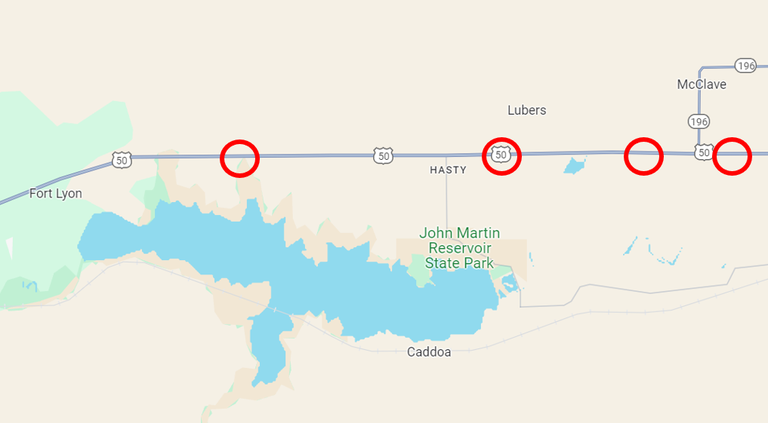
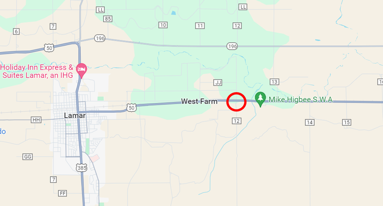
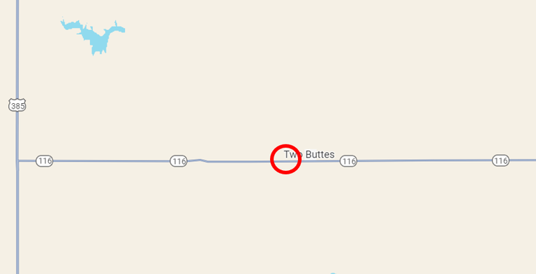
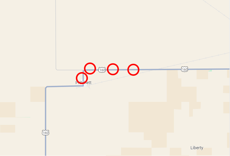
The project will happen in 15 different phases. All phases will work on adding steel sister beams to the existing damaged timber girders to strengthen the support to the bridge deck. Work will occur at various locations across Baca, Bent, Las Animas and Prowers Counties in Southeast Colorado:
- Phase 1: CO 101 at Mile Point 2.8 to MP 4.8.
- Phase 2: CO 101 from MP 6.4 to MP 8.4.
- Phase 3: US 50 at MP 409 to MP 411.
- Phase 4: US 50 at MP 415 to MP 417.
- Phase 5: US 50 at MP 418.5 to MP 420.5.
- Phase 6: US 50 at MP 420.8 to MP 422.8.
- Phase 7: US 50 at MP 438.5 to MP 440.5.
- Phase 8: CO 116 at MP 11 to MP 13.
- Phase 9: US 160 at MP 453 to MP 455.
- Phase 10: US 160 at MP 452.7 to MP 454.7.
- Phase 11: US 160 at MP 450 to MP 452.
- Phase 12: US 160 at MP 449.5 to MP 451.5.
- Phase 13: US 160 at MP 358.4 to MP 360.4.
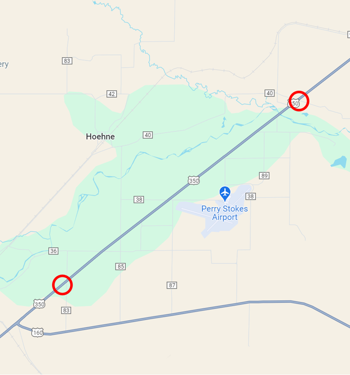
- Phase 14: US 350 at MP 6.7 to MP 8.7.
- Phase 15: US 350 from MP 1.7 to MP 3.7.
Traffic Impacts
Motorists and area residents can expect the following impacts during construction:
- Daytime work hours range from 7 a.m. to 7 p.m. Monday through Friday.
- Vehicles will be reduced to a single-lane, alternating traffic intermittently in either direction, at each location throughout the duration of the each phase of work.
- There will be a 12-foot width restriction in place.
- The project is scheduled for completion in late October.


Project Information
For additional information about this project:
- Webpage: codot.gov/projects/timberbridge
- Information hotline: 719-691-7079
- Email: [email protected]
Know Before You Go
Travelers are urged to “know before you go.” Gather information about weather forecasts and anticipated travel impacts and current road conditions prior to hitting the road. CDOT resources include:
- Road conditions and travel information: COtrip.org
- Download the COtrip Planner app: bit.ly/COtripapp
- Sign up for project or travel alerts: bit.ly/COnewsalerts
- See scheduled construction lane closures: bit.ly/laneclosures
- Connect with @ColoradoDOT on social media: Twitter, Facebook, Instagram and YouTube
Remember: Slow For The Cone Zone
The following tips are to help you stay safe while traveling through maintenance and construction work zones.
- Do not speed in work zones. Obey the posted speed limits.
- Stay Alert! Expect the unexpected.
- Watch for workers. Drive with caution.
- Don't change lanes unnecessarily.
- Avoid using mobile devices such as phones while driving in work zones.
- Turn on headlights so that workers and other drivers can see you.
- Be especially alert at night while driving in work zones.
- Expect delays, especially during peak travel times.
- Allow ample space between you and the car in front of you.
- Anticipate lane shifts and merge when directed to do so.
- Be patient!
Download the COtrip App!
The new free COtrip Planner mobile app was designed to meet the growing trend of information on mobile and tablet devices for the traveling public. The COtrip Planner app provides statewide, real-time traffic information, and works on mobile devices that operate on the iOS and Android platforms. Visit the Google Play Store (Android devices) or the Apple Store (iOS devices) to download!
