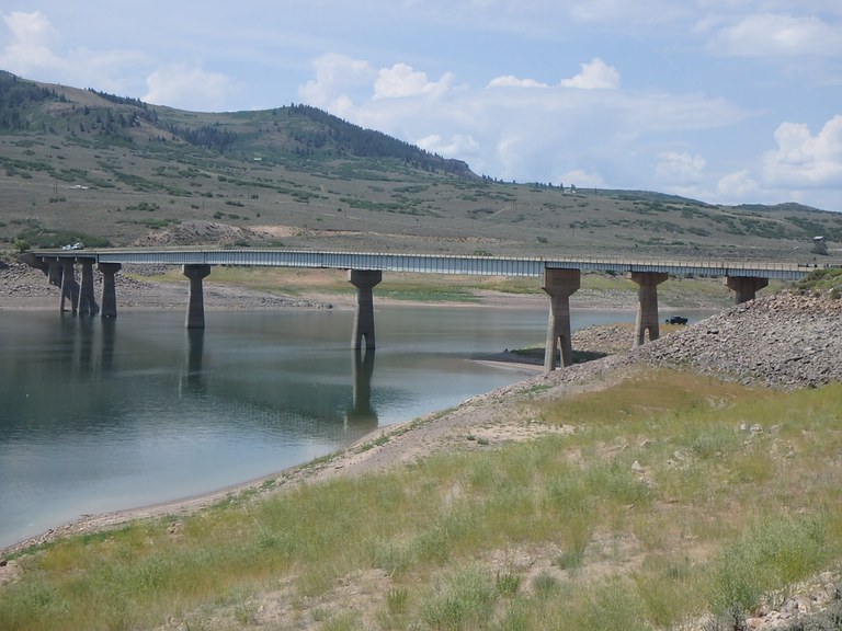
US 50 bridge closed west of Gunnison due to safety concerns
Travel Advisory

Gunnison and Montrose Counties — A safety closure is in place for a bridge on US Highway 50 located west of Gunnison. The Colorado Department of Transportation is closing the bridge at the urging of the Federal Highway Administration and state bridge engineering experts due to the findings of an ongoing safety inspection, which identified anomalies in the bridge on Thursday, April 18. The closure is in place between US 50 Mile Point 131 (intersection with Colorado Highway 92) and MP 138. Local traffic will be allowed through the closure point to reach residences. Motorists should use COtrip to plan an alternate route. See below for more information about the northern and southern recommended alternate routes. CDOT has set up an incident command and will coordinate with local, state and federal agencies in order to respond as quickly and effectively as possible.
CDOT has been conducting a special inspection for high-strength steel bridges for the Blue Mesa bridges as required by the Federal Highway Administration. This inspection was required because of known issues with similarly constructed bridges elsewhere in the country. A defect was observed during an early investigation of the bridge at approximately Mile Point 136.3. CDOT immediately brought in a second inspection crew with resources to perform another method for testing whether the defect posed a safety hazard on the bridge. The second inspection took place on Thursday, April 18.
CDOT is continuing to assess the safety of the bridge and to quickly determine options for interim and permanent fixes – and will keep the public informed as soon as more information is available. The bridge closure is located between Gunnison and Montrose. It is located east of the US 50 Little Blue Creek Canyon project, which is currently in a planned winter shutdown.
Recommended Alternate Routes
This closure will create a significant detour for commuters between Montrose and Gunnison. The recommended detour route for through traffic is via Interstate 70 to the north or US 160 to the south. CDOT understands the inconvenience that this creates and is rapidly evaluating options to improve options for residents, businesses, and travelers on the western slope. The northern route is 354 miles and requires approximately six hours of travel time. The southern route is 331 miles and requires nearly 7 hours of travel time. CDOT and local partners are exploring whether it is feasible at this point in the season to clear local seasonal routes that may be able to significantly reduce the detour time for local travelers.
Know Before You Go
Travelers are urged to “know before you go.” Gather information about weather forecasts and anticipated travel impacts and current road conditions prior to hitting the road. CDOT resources include:
- Road conditions and travel information: COtrip.org
- Download the COtrip Planner app: bit.ly/COtripapp
- Sign up for project or travel alerts: bit.ly/COnewsalerts
- See scheduled construction lane closures: bit.ly/laneclosures
- Connect with @ColoradoDOT on social media: Twitter, Facebook, Instagram and YouTube
Remember: Slow For The Cone Zone
The following tips are to help you stay safe while traveling through maintenance and construction work zones.
- Do not speed in work zones. Obey the posted speed limits.
- Stay Alert! Expect the unexpected.
- Watch for workers. Drive with caution.
- Don't change lanes unnecessarily.
- Avoid using mobile devices such as phones while driving in work zones.
- Turn on headlights so that workers and other drivers can see you.
- Be especially alert at night while driving in work zones.
- Expect delays, especially during peak travel times.
- Allow ample space between you and the car in front of you.
- Anticipate lane shifts and merge when directed to do so.
- Be patient!
Download the COtrip App!
The new free COtrip Planner mobile app was designed to meet the growing trend of information on mobile and tablet devices for the traveling public. The COtrip Planner app provides statewide, real-time traffic information, and works on mobile devices that operate on the iOS and Android platforms. Visit the Google Play Store (Android devices) or the Apple Store (iOS devices) to download!
