Geophysical Methods
Geophysics
Geophysics is the science of applying the principles of physics to investigations related to the structure and properties of the Earth. Throughout state and federal highway departments, the application of geophysical investigations has been increasing in site characterization.
Geophysical methods can be used to provide volumetric knowledge of unforeseen, highly variable subsurface ground conditions—assisting in highway design, construction, repair and maintenance phases. The ground conditions that transportation engineers are mainly concerned about during project planning include the thickness of unconsolidated overburden; bedrock depth; bedrock excavation; void location; and groundwater depth.
Each of these may significantly affect the design and construction phases of a project. The added knowledge of these conditions provided by geophysical methods may reduce project risk, costs associated with claims, and improve construction and safety.
Find a more detailed summary of geophysical methodology on the U.S. Department of Transportation Central Federal Lands website.

Seismic Refraction
Seismic refraction can provide a measure of material strengths and, consequently, can be used as an aid in assessing soil and rock rippability. In addition, it has been documented to successfully assess landslides.Seismic refraction measures the characteristics and depths of subsurface layers, providing data on the elastic properties of each layer. In addition, it's often used to enhance subsurface geotechnical investigations—especially where drilling access has physical or economic limitations.
It is important to note that successful interpretation requires correlation to nearby borings or geologic maps. Seismic surveys are not intended to replace traditional subsurface sampling and boring investigations, but aid in quickly and economically extending subsurface characterization over larger areas "filling in" the gaps between discrete borings.
Using seismic refraction surveys with boring data provides additional subsurface information between borings to characterize bedrock and to determine the suitability of these methods for additional subsurface explorations.

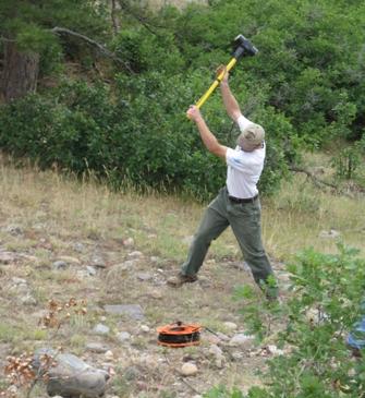
Seismic refraction measures the travel time of seismic energy in the form of waves transmitted by an impact from a sledge hammer, explosives or specialized equipment—depending on the depth required in the investigation. The creation of the seismic energy is referred to as a "shot." The seismic wave is detected by a line of sensors, called geophones, placed on the surface.
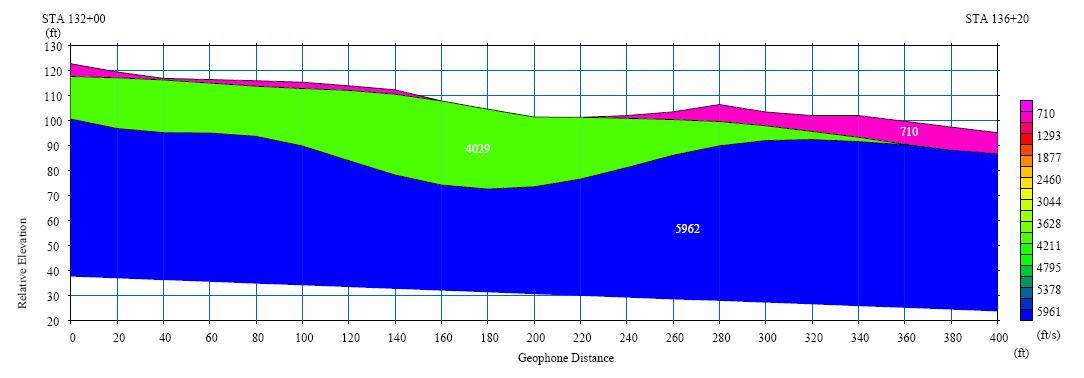
The time for the seismic wave to travel from the shot to the contrasting layer and then to the geophones can be used to determine characteristics of the layer. The seismic wave's velocity in the subsurface is highly dependent on the physical properties of the subsurface, such as density; porosity; water content; hardness; consolidation; depth; bedding; and fracturing. Typically, high seismic velocities are indicative of intact rock, dense, or highly compacted sediments.
On the other hand, relatively low seismic velocities are indicative of loose material, semi-consolidated sediments or weathered rock. The travel times can be used to make a cross section of the subsurface, as shown in the example below.

Shear Wave Analysis
The American Association of State Highway and Transportation Officials (AASHTO) publishes the Load and Resistance Design (LRFD) Bridge Design Specifications manual, which is constantly revised. This manual sets guidelines and requirements for bridge design in U.S. Section 3.10 of the manual, which discusses the seismic design requirements for bridges to prevent collapse during an earthquake.
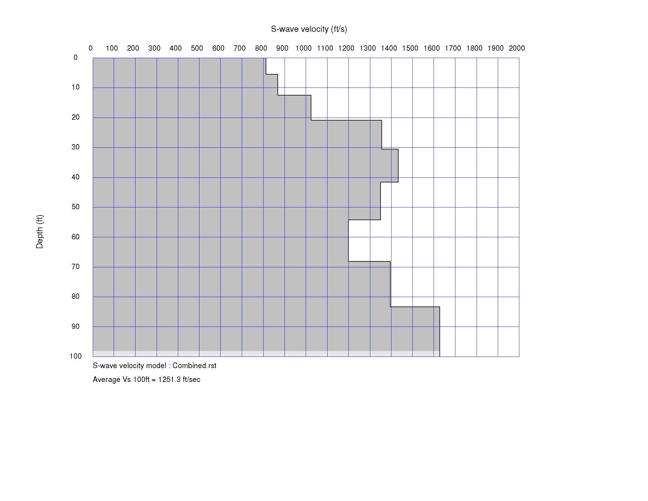
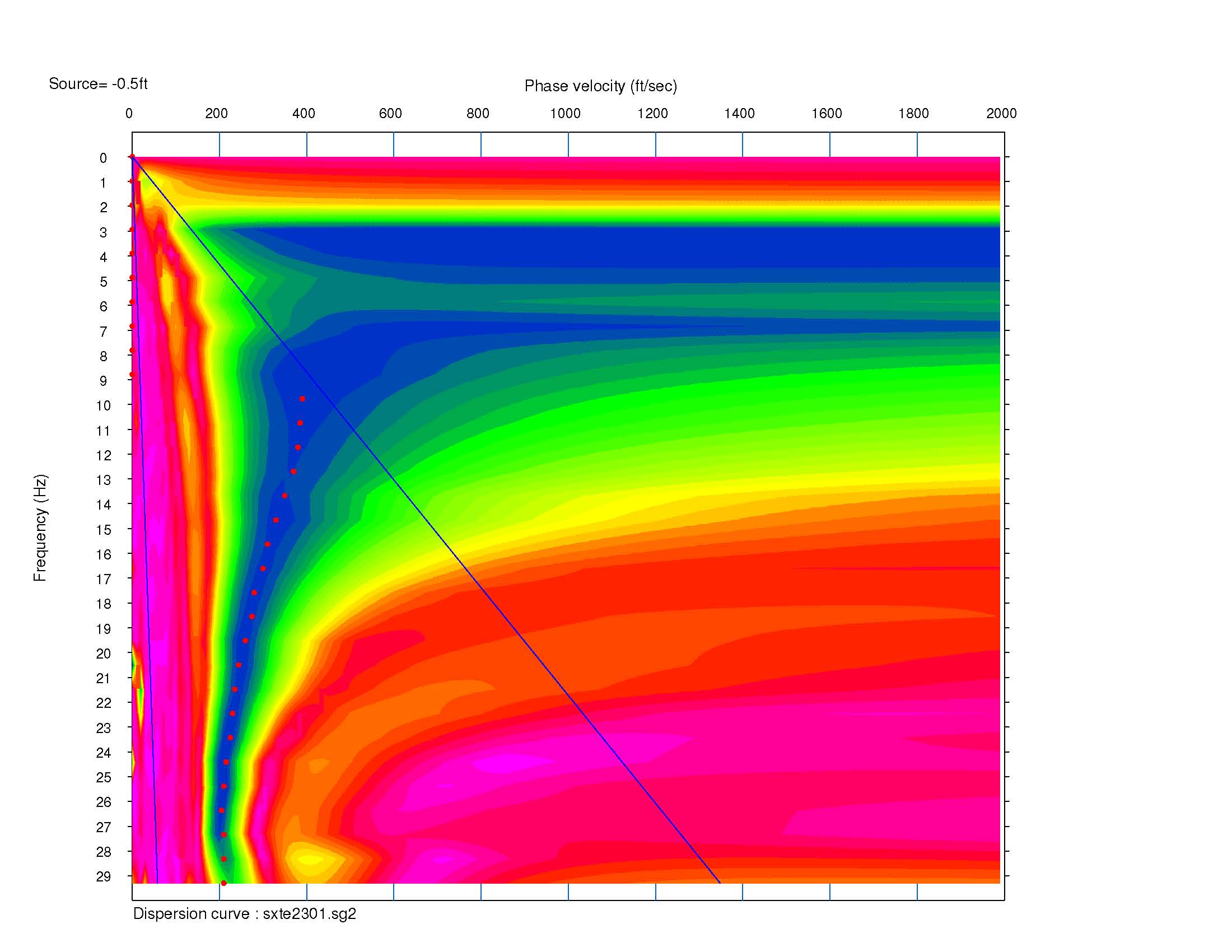
Specifically, each bridge location is assigned a Site Class Definition during the geotechnical exploration that is used in the bridge design. The Site Class Definition can be determined by using drilling methods, such as N-values or, more accurately, using shear wave velocity. The CDOT Geotechnical Program can provide shear wave velocity analysis, allowing the use of quality data by project bridge designers, and resulting in a more reliable, cost effective structure.


